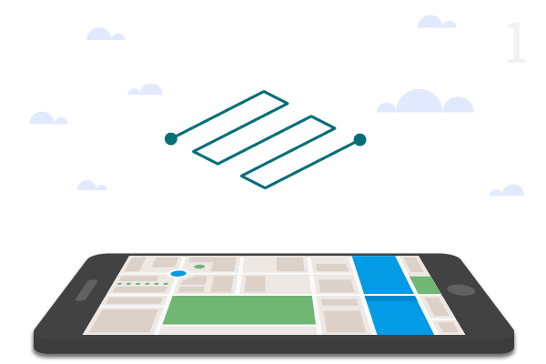
Aerial Surveillance, Survey & 3D Mapping

Most cost-effective and sophisticated tool-chain to record, measure, interpret and visualize 3-Dimensional geographic data using drones to assist any Survey, Mapping or Search and Rescue (S.A.R) missions.

What is Drone Survey/Mapping?

Drone Mapping or Survey is an alternative to traditional method of surveying, creating maps, gathering geographical/terrain data & creating many more advanced datasets that will provide a whole new perspective about terrain models to researchers & data analysts.

What was once considered virtually impossible and way too expensive to achieve is now being done every day autonomously with the help of drones.

How we DO IT?

Step 1

Waypoint creation for autonomous flight path over required land and setting up safe elevation distance
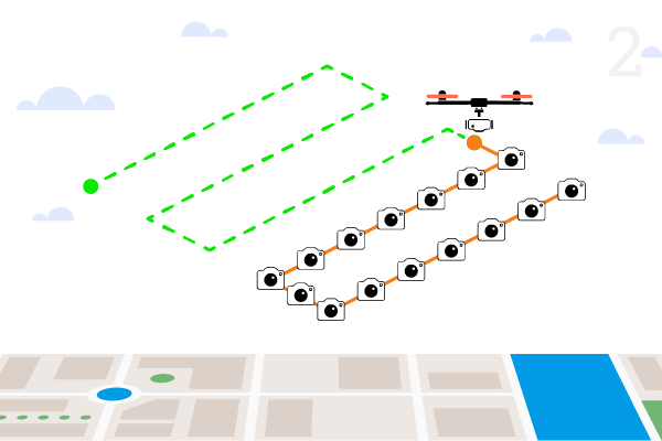
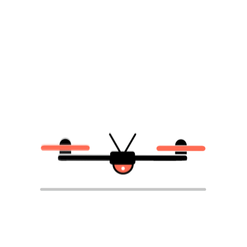
Step 2

Drone takes-off and follows the specified flight path capturing high resolution photos at preset intervals
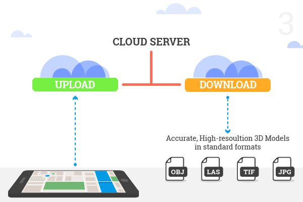
Step 3

After drone returns to base station, upload images and log files to the cloud server to render digital models or to preview 3D reconstruction of site online

Key Features

Point Clouds

Digital Surface Models

Textured Digital Surface Models

Classified Point Clouds

Ortho-rectified Imagery

Digital Elevation Models

Where UAVs can help?

  • Forestry and Natural Resources Management
  • Historical 3D Mapping of Sites & Monuments
  • Agriculture – Mapping Plant Growth, Moisture Levels & Yields
  • Environmental Monitoring
  • Counting Animal Populations
  • Glacier Surveillance
  • Ocean & Sea Research
  • Capturing the Spread of Algae
  • Surveillance of Sea Mammals
  • Identification of Plant Species
  • Meteorological Research
  • Mapping of Excavation Sites
  • Recording Saltwater Infiltration
  • Measuring Air Contamination
  • Archaeological Research
  • Studying Biodiversity
  • Climate observation
  • Radiation Monitoring & Measurement
  • Arctic Research
  • Geophysical Surveying

Maximum Output at Minimal Effort

Adapt to a very futuristic workflow equipped with more advanced technology and State of the Art smart devices.
Connect with Us to Know More